HMTG ITB’s Enigma Expedition: Revealing the Secret of Sumba
BANDUNG, itb.ac.id – Geological Engineering Student Union ITB, "GEA" ITB, carried out an expedition to Sumba Island, East Nusa Tenggara. This expedition is a way to apply geological science through direct field practice.
Arieq Bagus, the Leader of the Expedition, said that this Enigma Expedition was participated by 12 students. Enigma was chosen as the name of the expedition because it symbolizes the character of Sumba Island's geological structure, which is complex and dynamic. In addition to that, it also has several unexplained mysteries which require further research.
"We want to explore this unknown territory through an expedition named "Spirit of Geology: Exploring the Sumba Enigma," said Arieq.
The main programs of this expedition are exploring the hydrogeology of Sumba Island to map the clean water potential and conducting a geo-tourism potential survey. This expedition was focused on the eastern side of the island.
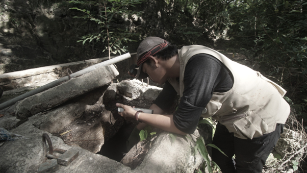
"The residents of Eastern Sumba are faced with a clean water crisis. Their demand exceeds the existing capacity of water sources. They resolved to use rainwater that seeps into artificial holes called kullup. However, these kullup are located far away and with difficult access. Besides, several drills to look for underground water sources have been tried but with minimum success. The surveys conducted were still conventional and unable to calculate the actual water volume," said Alvin Haniel (Geological Engineering, 2019).
He then said that hydrogeology investment is needed. "We sought and mapped water springs, wells, and ponds. We were helped by local residents who are very familiar with every corner of Eastern Sumba. We measured water quality and groundwater elevation to create a groundwater contour map. If there is a contour map, there won't be any failed drilling."
Faikar Kamaluddin (Geological Engineering, 2019) said that there is no data digitization and inventory regarding the location of water sources in Eastern Sumba. A total of 50 water sources were inputted into a geospatial information system which later will be published in the form of a scientific paper. The obtained result was also shared to residents.
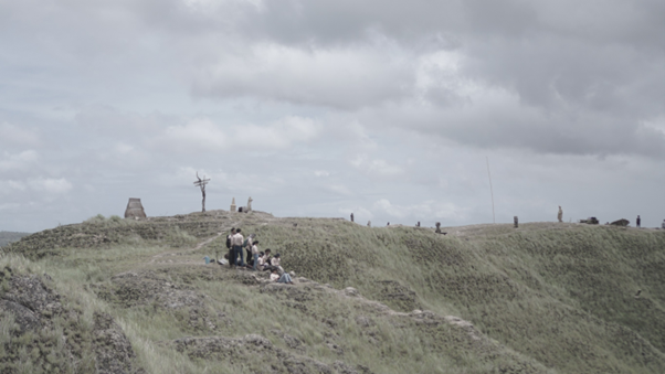
Moreover, the expedition also carried out a geo-tourism and socio-cultural survey. "We made a geo-tourism signpost. The signpost contains the route of natural attractions in Eastern Sumba. The signpost will be placed on Bukit Marinding, which is the main path when entering Eastern Sumba. We also added information on Bukit Warinding from geological and historical standpoints," said Arieq.
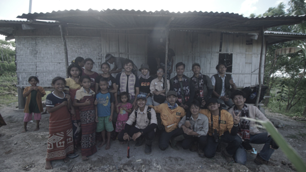
The students want to show the beauty of geo-tourism in Eastern Sumba through a documentary video to increase the region's popularity. "We followed several figures from 7 villages in Eastern Sumba. This video talks about how Sumba is living proof of the richness of Indonesia. However, it still has many problems outside the scope of geology, such as infrastructure, nutrition, education, and environment. It is hoped that other parties will be sympathetic and contribute to solving these issues," said Alvin.
Enigma Expedition was held from 1 to 19 January 2023. The team has been carrying out preparation for 3 months before the departure date. Transportation and infrastructure aspects became their biggest challenges. Arieq felt the importance of students' participation in that journey.
"Sumba has truly opened our eyes to the fact that there are so many people out there who need help and avocation. We, as university students, shall act as its agent, and community service shall be its instrument," added Faikar. He hopes that this activity can continue to exist and become an inspiration for others.
Reporter: Maharani Rachmawati Purnomo (Oceanography, 2020)
Translator: Favian Aldilla R (Civil Engineering, 2019)

scan for download