Appearance of Volcano with Low Likelihood of Eruption at South Pacitan
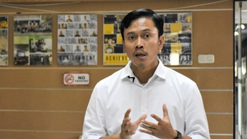
BANDUNG, itb.ac.id – Recently, the public was shocked by the discovery of an underwater volcano. The Geospatial Information Agency located it during an Extensive Continental Shell survey south of Pacitan, East Java. Amidst the rising uneasiness from the public, Indonesia's volcanologists speak up about this particular underwater volcano, and one of them is Dr. Mirzam Abdurrachman, S.T., M.T. from the ITB Geological Engineering study program.
During an interview on Tuesday (14/3/2023), Dr. Mirzam explained that the subduction on the southern side of Java is heavily related to the formation of its volcanoes. The subduction that began around 55 million years ago resulted in magmatism, which led to a series of volcanoes emerging on land, stretching from West to East Java.
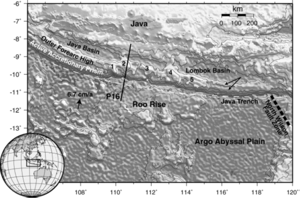
The majority will assume that volcanoes always stretch from west to east. However, their distribution only sometimes constitutes a straight line due to the complexity of the subduction zone on Southern Java Island. Several factors are responsible for the complexity, including the rate of subduction that can reach 6,7-7 cm/year, the difference in the ages of the continental shells that subduct the three sides of Java Island, and the disparity in the compositions of Java Island's outer crust.
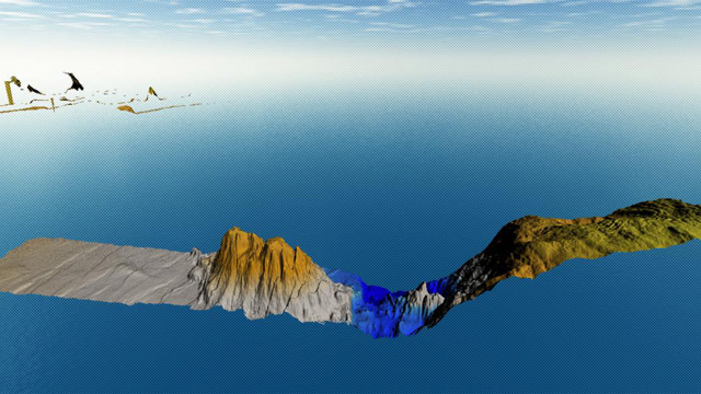
One interesting geological feature in Java Island is the Roo Rise, an oceanic plateau with an area of around 25.000 km2 and a mean depth of 15km. The backtracking of the trench causes such a feature to occur in the northern region for 60km. Began around 1,1 to 1,3 million years ago, its intrusion in the trench results in a protrusion from East Java to South Lombok, now identified as underwater mountains as labeled from number 1 to 5 in the picture below. There are 5-10 protrusions that have been placed since 2006.
Dr. Mirzam concluded that the appearance of a volcano in South Pacitan is caused by the effects of subduction zones, such as inhomogeneous components, age differences of the tectonic shells, and the existence of roo rise that causes interferences.
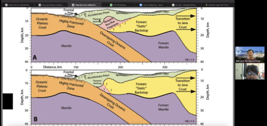
Further analysis shows the roo rise intrusion towards the trench will be partially sliced off. Some slabs that collide with Java Island's plate will cause the roo rise to be fragmented and buoyant, creating the protrusion and insertion of the slabs beneath the island plate. Some of the slabs that went beneath the plate will determine the danger level of the underwater mountain.
Unlike most active volcanoes on Java Island, the intruded slab is still relatively shallow (10-15 km), so it does not cause any 'volcanic' potential. "The intruded slabs will not melt at 10-15 km depth. It is not the ideal place. The ideal depth for an oceanic plate to melt is 120-180 km, just like other volcanoes on Java Island," he added.
The characteristic that indicates the formation of a volcano is the collision of two plates in the accretion zone. "Theoretically, we ought not to only focus on its location, but also its morphology."
Even if the probability of the volcano erupting is low, any nonvolcanic disaster must be kept in mind. This high mound can become unstable and cause an underwater landslide. If its volume is large enough, it will disturb the balance of seawater columns. "If there is a seismic gap, slope instability can happen." Dr. Mirzam stated. To monitor and mitigate such incidents, interdisciplinary collaboration is encouraged.
At the end of the interview, Dr. Mirzam hoped that ITB and all academicians in Indonesia could actively participate in improving the current disaster mitigation plans. As academicians, they provide the basic data required for the matter, and they can do this by educating the newer generations and sending them to discover further information.
Disaster awareness is a must in minimizing the impact of potential disasters. "Readiness of the people to face these disasters head-on can start in their education, especially with those who live in countries with active geological conditions," he said.
Reporter: Kevin Agriva Ginting (Geodesy and Geomatics Engineering, 2020)
Translator: Favian Aldilla R (Civil Engineering, 2019)

scan for download