ITB Tsunami Expert Conducts Study around Tsunami Affected Locations in Palu

PALU, itb.ac.id – ITB tsunami expert, Dr. Eng. Hamzah Latief from Oceanography Research Group, Faculty of Earth Sciences and Technology (FITB) of Institut Teknologi Bandung (ITB) conducted direct observation to tsunami affected locations in Palu and surrounding areas on Wednesday (10/10/2018). During the observation, several data related to the tsunami were found.
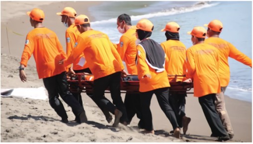
On 28 September 2018, Palu, Central Sulawesi and surrounding areas were hit by a magnitude 7.4 accompanied by tsunami, wrecking many buildings and killing and injuring thousands in the process. Many were declared missing after the disasters.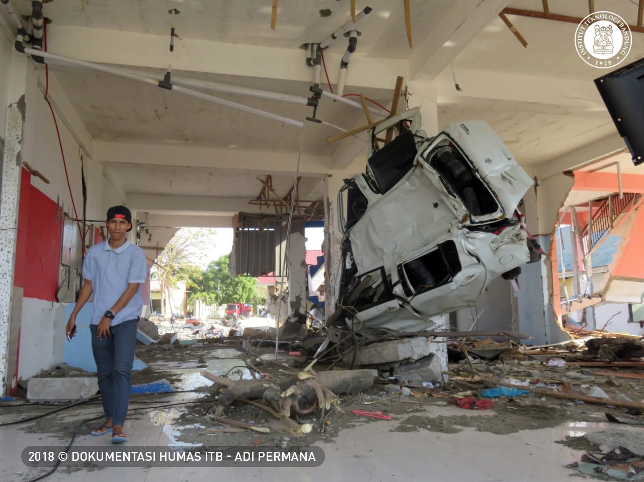
Together with ITB team, National Study Center for Earthquake (Pusgen), LIPI, and Ministry of Public Works and Public Housing (PUPR), Hamzah conducted survey to various tsunami affected locations such as Watusepu Beach, Buluri, and Talise. Eyewitness to the disasters were met and interviewed during the survey.
Hamzah said that, the eyewitnesses saw the tsunami occurred shortly after earthquake. “The Tsunami came suddenly after the earthquake. It spread to all direction. After 6 minutes, the tsunami was noted to happen in Pantoloan based on tidal condition and after 4 minutes in Watusepu,” he said
He also measured the height of tsunami in several locations such as under the collapsed Punulele Bridge in Palu. The height of tsunami is identifiable by looking at the remains of garbage on the 5 meter-tall walls that held the bridge. In other locations, the heights are varied from three to four meter.
“The ugliest tsunami hit Talise where more than 200 people were found dead,” said Hamzah. Even the shortest tsunami hit beaches, residents, buildings and public facilities in Central Sulawesi.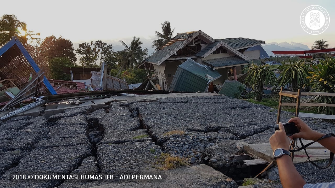
The process of the tsunami, Hamzah said, began with a strike slip in Palu-Koro Fault that caused earthquake. The shock caused sediment avalanche to happen under the sea. The avalanche came from river that carried sediment deposited at river mouth. When the fault moved and made vibration, the sediment slid down and generated tsunami.
“Palu Bay has varied slope depths from shallow to 500 meter. Because of this factor (sediment avalanche), the water surface raised. But it is not clear yet whether the sediment avalanche came from Talise Beach or somewhere else,” he said.
Hamzah also saw the occurrence of land subsidence, especially on area around Panulele Bridge. The same thing happened to floating mosque on the seafront which now is submerged in the water. “Possibly there occurred lateral spreading,” he said.
Palu-Koro Fault is said to be very active with movement about 44 millimeter each year. Many studies or researches about this fault were carried onto dissertation. Palu-Koro Fault is one of active faults in Indonesia that divides Central Sulawesi and Southeast Sulawesi.
ITB began researching about Palu Koro Fault in 2012, and the result has been presented to local government, BNPB, and President expert staff. Historically, Hamzah said, local residents already have the knowledge on earthquake, tsunami, and liquefaction in their local languages.
“After the survey, mappings on the danger of tsunami should be considered in spatial planning. Buildings constructed should be tsunami resistant,” he concluded.
Reporter : Adi Permana

scan for download